GIS Applications Development

Geographic information systems have turned the idea of maps and their role in our lives upside down. Especially relevant is the use of GIS in business, where it is necessary to track, detect and collect information about the location of the user. Programs with a GIS component are aimed at collecting, analyzing, and editing spatial information using modeling and visualization methods.
By tracking location in real-time based on modern technologies, such program helps scale the business and improve the quality of services. Below we will explain what a geographic information system is and what to look for when developing GIS programs for your business.
Application of GIS and its role in various industries
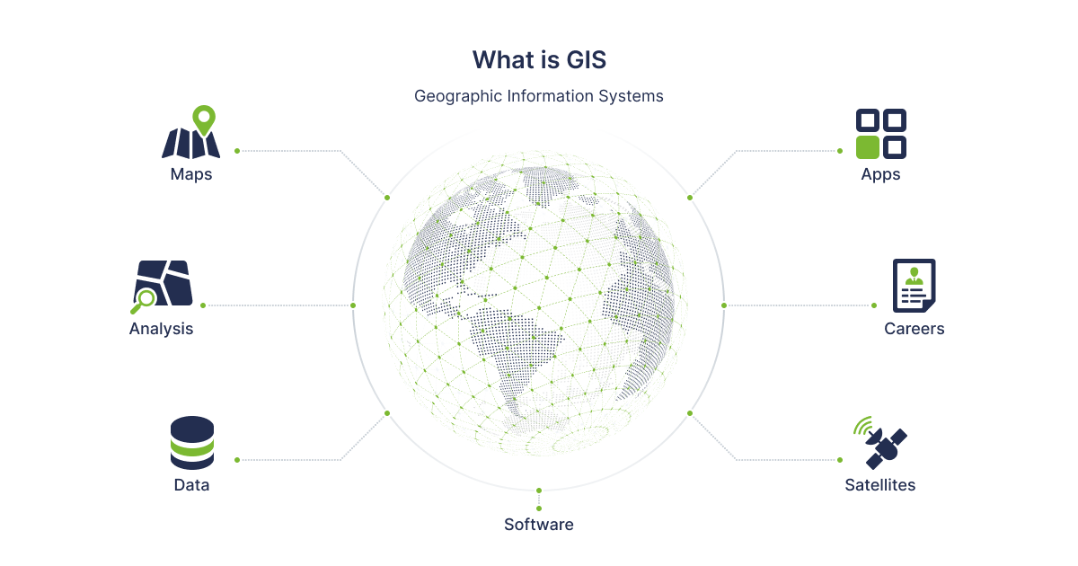
The geographic information system is aimed at collecting, storing, verifying, and displaying information relating to objects on the surface of the Earth. Examples of such applications are Google Maps and Uber, which use map images of streets, satellite images, 3D models of the planet's surface, and traffic data.
The geographic information system is applicable in the following areas:
- At enterprises where it is necessary to determine the location or movement of objects, transport, and workers, including agriculture, logistics, production, security, delivery services, etc.
- In marketing for more precise targeting of advertising, which is possible due to an accurate understanding of where the potential consumer is located.
- At the state level, the use of geographic systems makes it possible to monitor health of citizens, the attitude of the population to the municipal measures taken, and implement measures to eliminate the consequences of accidents and natural disasters.
- Ecology is another area of human activity where GIS systems are indispensable. The technology enables to track changes in green areas and species populations as a result of environmental pollution, etc.
This is just a small list of industries where GIS is widely used. The GIS software market is growing and scaling, with a projected value of $25.5 billion by 2030.
Goals of GIS Applications
GIS applications perform several functions to make it easier to manage information in one place. To ensure multifunctionality, it is important to include the following aspects in the development:
- collection of information. Programs process maps, photos (including satellite ones), and spreadsheet data (applicable when working with demographic statements). It is possible to overlay data, add different document formats, etc.;
- spatial relationships. To do this, all information is combined and unified by the scale. The relevance of such a correction can be traced when 2d and 3d format maps are superimposed when something needs to be cut or added. For this purpose, data from several resources are used with their unification;
- display. Depending on the tasks the user faces, you can opt to display the map with one or more layers for a more detailed analysis;
- analysis. Simple observation of the map without critical analysis in automatic mode does not give an understanding of the patterns that will open up during machine data processing. This analysis is especially useful when evaluating historical data.
Read also: How to Create Location-Based Applications: Main Features
Basic GIS elements
The main elements of a GIS are:
- data;
- software;
- hardware component;
- functionality;
- staff.
Required features for a GIS application
For the program to work comprehensively and cover all processes, it is important to ensure the implementation of the following functions during the development process:
- Multilayer display. It is desirable to enable the ability to overlay several administrative-territorial units, information on individual categories and users, statistical statements, names, geotags, etc.
- Mapping or data visualization. The ability to build maps based on graphs and GPS coordinates, color map sections based on data (for example, population density), and attach images makes using applications useful and efficient.
- Map navigation. Zooming in and out for a more detailed study of areas is required when using programs designed for different business sectors.
- Exporting and printing make it possible to show parts of the map to those users who do not have access to cartographic and information systems. In addition, it is easier for a segment of the audience to perceive information from a material carrier.
- Distance measurement — on a linear or 3D map, for a pedestrian or a driver.
- Requesting a buffer zone is relevant for studying data from a limited area of the map and not the entire area.
- Geocoding is the basic principle on which web-based GIS applications are developed. It aims at producing more realistic and stable statements.
What tools are used to develop GIS applications
To develop a mobile GIS application, you may need, for example, the following tools:
- Leaflet.js - an open-source library;
- Turf.js - a library for calculating distance;
- OpenStreetMap - a collection of data on natural and man-made objects;
- OpenLayers - a solution for working with dynamic maps on the Internet;
- GEOS - Technology for Spatial Actions;
- Boost.geometry - a tool that allows you to process different types of geometric data and algorithms;
- Assimp - a technology for importing 3D data;
- OGR - a solution for importing vector formats;
- Azul - a tool for creating a three-dimensional model of cities in MacOS;
- QGIS - a visualization tool;
- Mapbox - a map library.
|
GIS Application Development Process |
Explanation |
|
Define requirements |
The first step in the GIS application development process is to define the project requirements, such as data sources, functionality, and user interface. |
|
Design system architecture |
Once the requirements are defined, the system architecture should be designed, including hardware and software components, data storage, and networking. |
|
Develop data model |
The data model defines how the spatial and attribute data will be organized and stored in the GIS application. |
|
Create the user interface |
The user interface should be designed to allow users to easily interact with the GIS application, including selecting layers, adding data, and performing analysis. |
|
Implement GIS functionality |
The GIS functionality should be implemented, including data import and export, querying, geoprocessing, and map rendering. |
|
Test and debug |
The GIS application should be tested thoroughly to ensure that it meets the requirements and works correctly. Bugs and issues should be identified and resolved. |
|
Deploy the application |
Once the GIS application is tested and debugged, it can be deployed to the production environment. |
|
Maintain and update |
The GIS application should be regularly maintained and updated to ensure that it continues to meet the needs of the users and remains compatible with changing technologies. |
Software Development Hub is a development team that creates GIS-based products for telemedicine, education, healthcare, e-bookkeeping, home automation, and security solutions. The high qualification and experience of our employees allow us to implement the client's ideas in accordance with his/her business tasks and current challenges in the industry. We will offer effective and cost-effective solutions to bring your ideas to life and scale your business.
Categories
About the author

Python Developer at Software Development Hub with over 4.5 years of experience. He designs, develops, and maintains robust applications of various sizes. Adept at building APIs, integrating third-party services, and leveraging modern development tools.
Share


Need a project estimate?
Drop us a line, and we provide you with a qualified consultation.